During the next 24 hours, moderate to heavy rain is very likely over West Bengal, Bihar, Uttar Pradesh, Rajasthan, Madhya Pradesh, Gujarat, Goa, Karnataka, Uttarakhand, Jharkhand, Chhattisgarh, Himachal, Haryana, Delhi, Rajasthan and Andhra Pradesh. The Meteorological Department has issued an ‘Orange Alert’ for Delhi-NCR.
Bihar
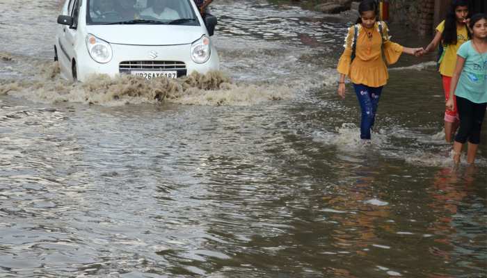
With the arrival of monsoon, the Meteorological Department has issued a red alert in view of the possibility of heavy rains in many states. According to the Skymet Weather report, a low pressure area has formed in the central part of North India. Whereas, a turf line is going from north-west Rajasthan to north-east Bay of Bengal and a turf line is going from Rajasthan to Bay of Bengal via Madhya Pradesh, Jharkhand and West Bengal.
During the next 24 hours, moderate to heavy rain is very likely over West Bengal, Bihar, Uttar Pradesh, Rajasthan, Madhya Pradesh, Gujarat, Goa, Karnataka, Uttarakhand, Jharkhand, Chhattisgarh, Himachal, Haryana, Delhi, Rajasthan and Andhra Pradesh. The Meteorological Department has issued an ‘Orange Alert’ for Delhi-NCR.
- Rain continues in Rajasthan
Moderate to heavy rains were recorded in some parts of Rajasthan during the last 24 hours. Niwai of Tonk and Dechu of Jodhpur in the state received maximum rainfall of 11-11 cm. According to the Meteorological Department, due to the advance of the South-West Monsoon in the state, there has been widespread rainfall in the state and the conditions are favorable for its further progress.
It is cloudy since morning in the capital Jaipur. Intermittent heavy rains occurred at many places in the city after noon, due to which the commuters had to face problems in traffic due to waterlogging at many places.
The department has issued a warning of heavy rain in Ajmer, Bhilwara, Bundi and heavy rain in Banswara, Baran, Chittorgarh, Dungarpur, Jhalawar, Kota, Pratapgarh, Rajsamand, Sawai Madhopur, Tonk, Udaipur, Nagaur and Pali on Friday.
- NDRF deployed in Karnataka
Coastal districts in Karnataka, Dakshina Kannada and Udupi have predicted heavy rains in the next 10 days. Coastal districts may receive moderate to heavy rainfall i.e. 64.5 mm to 115 mm while some places may receive heavy rainfall up to 244.4 mm during the same period.
There is also a possibility of lightening and thundershowers at various places in all the coastal districts of Karnataka. High waves can also arise along with heavy rains in the coastal areas, which can result in waterlogging and flooding of low-lying areas.
Keeping in mind the situation, the district administration has given instructions to deploy water pumps and other equipment in these areas. The monitoring center has also asked the administration to deploy National Disaster Response Force (NDRF) and State Disaster Response Force (SDRF) personnel in sensitive areas to prevent any mishap.
Fishermen have been asked not to venture into the sea as winds with a speed of 45 to 55 km per hour are expected to blow during the stormy weather off the Karnataka coast till July 2. During this time the height of the waves will be from three to 3.2 meters.
- heavy rain in gujarat
Many parts of South Gujarat received heavy rains during the last 36 hours and more rains are expected in the next two days. Heavy rains threw life out of gear and affected traffic in Valsad, Surat, Navsari and Tapi districts of south Gujarat as the heavy rains flooded low-lying areas and blocked roads in some parts, according to Met officials. Gone.
The IMD predicted heavy to very heavy rainfall at isolated places on Friday across Gujarat including Navsari, Valsad, Dahod, Sabarkantha, Mahisagar, Vadodara, Tapi, Bharuch and Junagadh districts. Apart from this, there is a possibility of “heavy rain” at some places in South Gujarat region on Saturday.